Cholera Map of Ireland, 1866
 |
| Restored cholera map of Ireland, 1866 (MS/95) |
Last week the
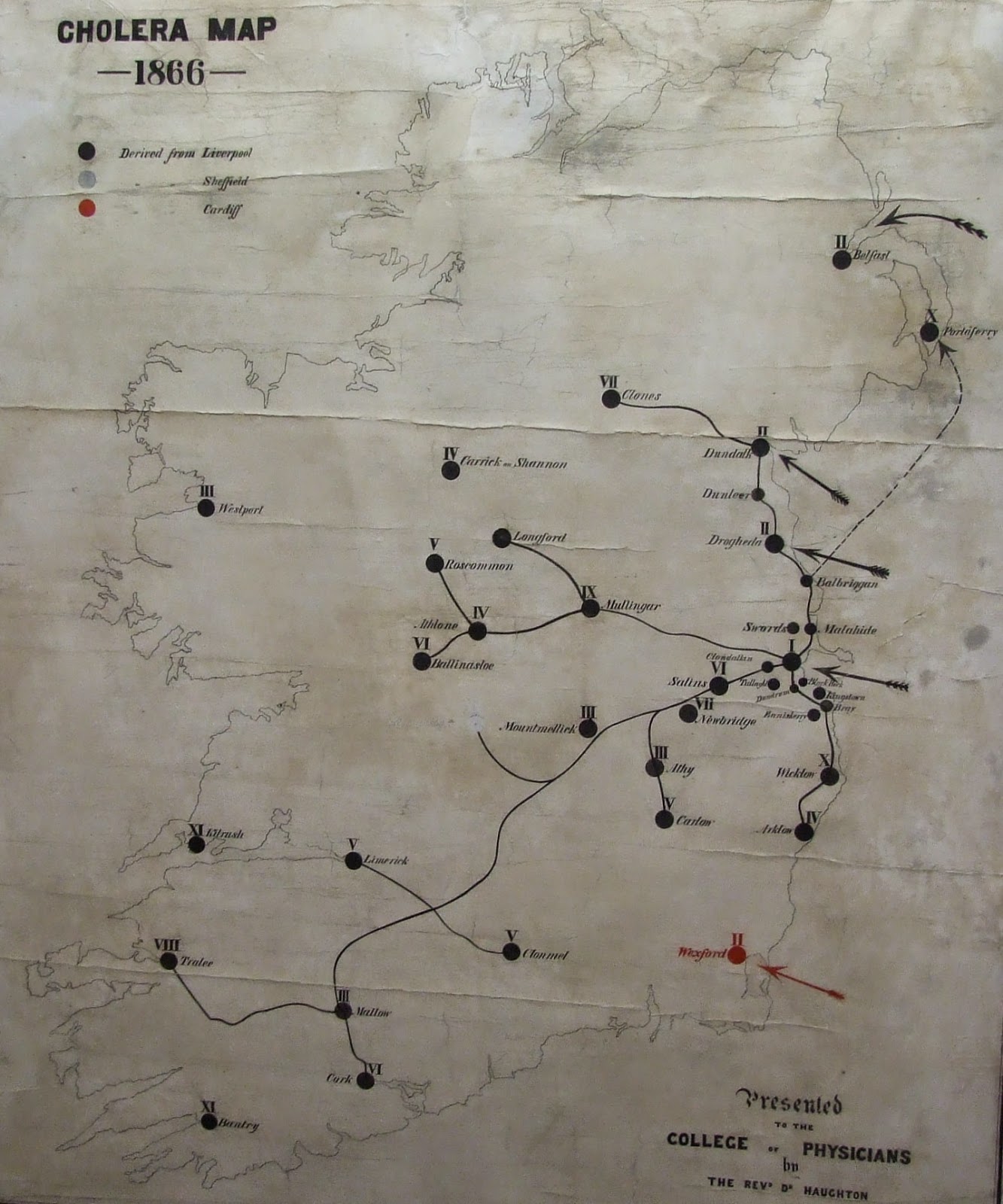
RCPI archival collections were enriched by the return a cholera map of Ireland in 1866, pictured above. This large and visually impressive map,
measuring 130cm X 110cm, has recently been restored by a professional
conservator, Louise Walsworth-Bell.
 |
| Recto of map before treatment |
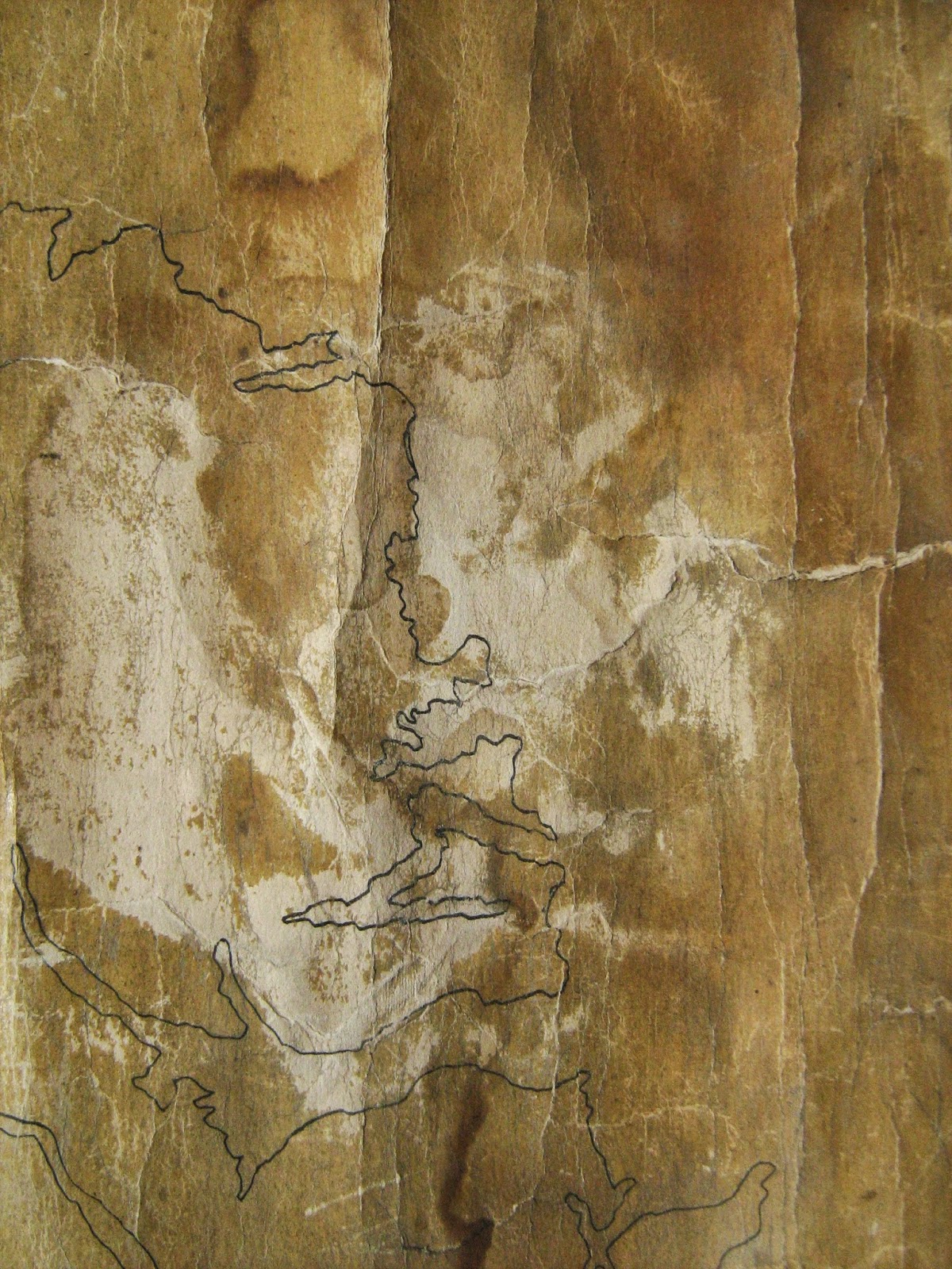
Prior to treatment the map was in poor condition, difficult to read, and therefore unfit for consultation by readers. A range of problems were apparent, such as extensive cracking, torn fragments, loss of varnish and exposed linen. Interventions such as thorough cleaning, flattening and repair works have restored the map to close to its original state, and made it accessible again.
 |
| Pre-treatment photograph showing central loss of varnish |
So what is the map about? It was produced
by Dr Samuel Haughton (1821-1897), a Fellow of the College of Physicians, to
demonstrate the spread of Asiatic cholera in Ireland in 1866. An smaller image
of the map was reproduced in Haughton's article 'A scientific inquiry into some
of the causes alleged to produce Asiatic cholera', published in the London
Medical Times and Gazette in 1867. In this article Haughton argued that cholera
travels 'along the lines of human traffic, and improves its rate of locomotion
as the facilities of human intercourse improve'.
The lines on the
map call to mind the railway network which had been developed in Ireland in the
mid 1800s. Haughton used such imagery to demonstrate his contact theory on the
course of the cholera in Ireland, and its progressive appearance at various
points. In his article, Haughton explains the numbers on the map as follows:
 |
Cartoon of Samuel Haughton by Spex for Ireland's
Eye entitled 'Haughton minus Galbraith plus Cairns'
(VM/1/2/H/16)
|
I. Dublin - this
city received its first case of cholera in the person of a young woman named
Magee, who imported the disease from Liverpool into No. 22, City Quay, from
which point it spread all over Dublin and the suburban towns, 'destroying in
six months 1193 persons'.
II. The towns of
the second grade are Belfast, Dundalk, Drogheda, and Wexford. Of these towns,
the first three imported their cholera directly, by sea from Liverpool, and the
fourth town, Wexford, received its cholera, by sea, from Cardiff, in South
Wales.
III. The towns
of the third grade are Mountmellick, Athy, Mallow, Westport, Sallins, and
Limerick. In all these cases there was distinct evidence of the importation of
cholera, either from Dublin or directly from Liverpool.
Cholera was
introduced into the neighborhood of Athy, and into Mallow, directly from
Liverpool ; and its entrance into Westport was traced by those residing in the
neighborhood to importation from Liverpool.
IV. The towns of
the fourth grade are Arklow, Carrick-on-Shannon, Longford, and Athlone.
V. The towns of
the fifth grade are Carlow, Roscommon, and Clonmel. Haughton traced the
introduction of cholera into Carlow to a case imported from Dublin.
VI. The towns of
the sixth grade are Cork and Ballinasloe. Cork was threatened, early in the
season of pestilence, by the arrival of the Helvetia
off the harbour, crowded with German emigrants, among whom cholera had broken
out. The Helvetia was ordered back to
Liverpool, and imported the disease into that town, from which place it was
subsequently introduced into Cork. Ballinasloe received its cholera from
Drogheda.
VII. The towns
of the seventh grade are Clones and Newbridge. Cholera was introduced into
Clones from Dundalk, and into Newbridge from Dublin.
VIII. Tralee.
IX. Mullingar and
Parsonstown [now Birr, County Offaly]. Parsonstown received its cholera by
importation direct from Sheffield, in England ; and this town and Wexford are
the only places in Ireland that received cholera from any other centre than
Liverpool directly or indirectly.
X. Wicklow and
Portaferry. The cholera was introduced into Portaferry, as shown on the map, by
a herring boat from Balbriggan, and not from Belfast as might be supposed.
XI. Kilrush and
Bantry.
Haughton’s
cholera map is catalogued under the reference number MS/95, and is available to
consult in RCPI Heritage Centre.
Fergus Brady,
Project Archivist